Sign In / Sign Out
Navigation for Entire University

LunaH-Map builds upon decades of technologies demonstrated in Earth orbit, and will address lunar science questions that have so far only been tackled by bigger missions, teams and spacecraft. The LunaH-Map spacecraft is the size of a large shoebox but has many of the major components you would find on larger spacecraft, including a solar array; an ion propulsion system; a guidance, navigation and control system; a flight computer; and a deep-space radio. LunaH-Map will only carry one science instrument, a neutron spectrometer, around which the entire spacecraft has been built.
In order to “see” into the Moon’s permanently shadowed regions with the neutron spectrometer, LunaH-Map will enter an elliptical orbit around the Moon, flying very low over the lunar terrain (8–20 km or 5–12 miles over the South Pole). The scientific goal of the mission is to determine the major sources of water-ice at the lunar poles by producing a neutron map of the permanently shadowed regions. The map can also be used to help future missions that wish to use lunar water as a resource and may add to our knowledge of how water formed and evolved at the Moon’s poles.
The LunaH-Map team aims to demonstrate that small, highly focused, science-driven, agile spacecraft can serve as secondary payloads on bigger NASA missions and can enhance the primary mission science, or even make unique discoveries of their own.
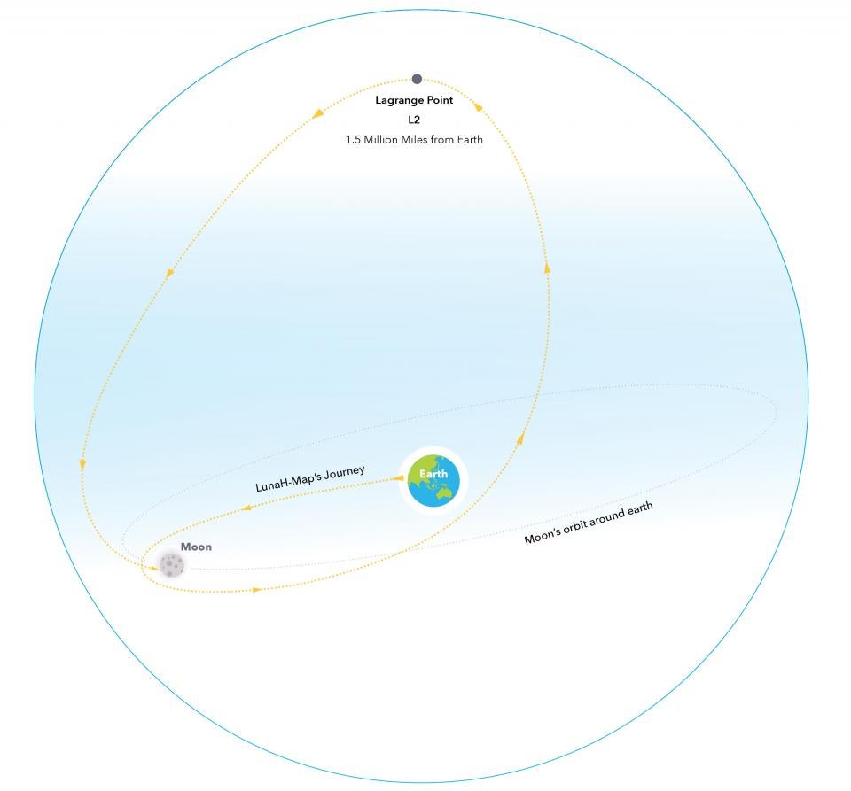
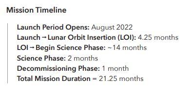
NASA’s LunaH-Map is a secondary payload on the Space Launch System (SLS) Artemis I mission. LunaH-Map will deploy from the SLS Orion Stage Adapter after separation from the Orion spacecraft, about five and a half hours after the launch of Artemis I (after passing through the Van Allen radiation belts). Shortly after the spacecraft makes contact with the Mission Operations Center at ASU, commissioning of the various spacecraft subsystems will continue for 24 hours after launch. One to two days after launch, the LunaH-Map propulsion system will be used to target a lunar gravity assist that will send LunaH-Map on a trajectory that allows the spacecraft to eventually return to the Moon and become captured in a high altitude circular orbit.
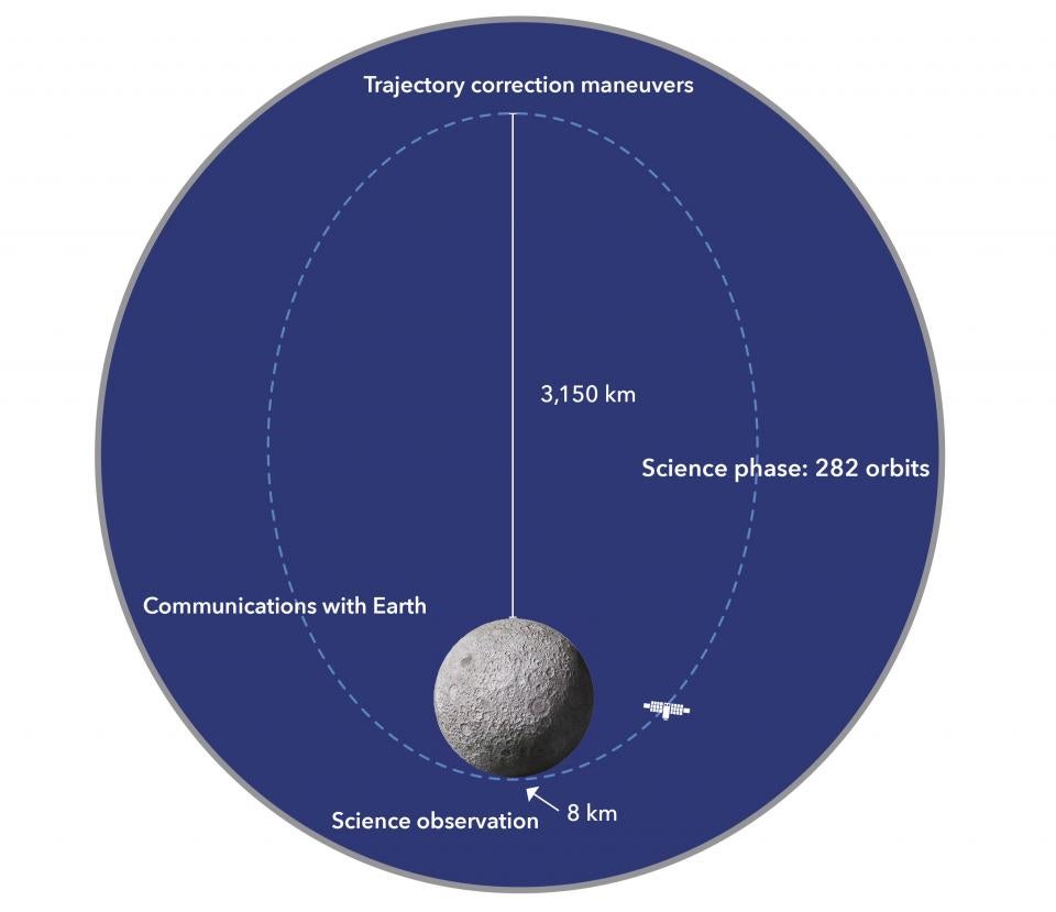
It will take several months for the spacecraft to be weakly captured by the Moon’s gravity. Then, within about one year, LunaH-Map will achieve an elliptical orbit. At its farthest point in this orbit, the spacecraft will be 1,957 miles (3,150 kilometers) from the surface of the Moon’s North Pole, while its nearest point will be 5 miles (8 kilometers) above the moon’s south pole.
Once the spacecraft has entered its science orbit, the mission will begin its science phase, during which neutron measurements will be made as the spacecraft flies by the South Pole during each orbit. The orbital period is about five hours, and communication with the spacecraft is achieved using NASA’s Jet Propulsion Laboratory Deep Space Network (DSN). Radio contact and maneuver planning will occur every three to five days, with science data downlinked back to Earth on each contact. After the science data have been transmitted back to Earth and most of the fuel reserves consumed, LunaH-Map will de-orbit into the moon.
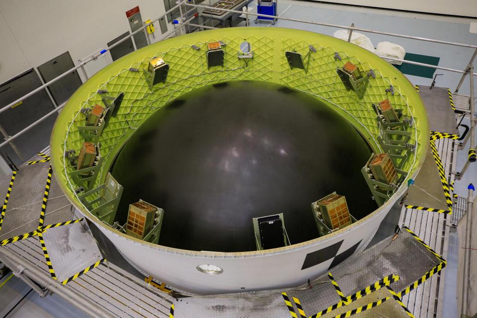
Orion Stage Adapter Ring holding the CubeSats. Image/NASA Kennedy Space Center
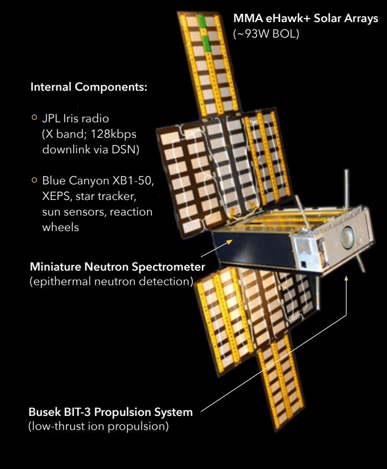
LunaH-Map Flight Systems Details
| Dimensions | 10 x 20 x 30 cm |
| Mass | 14 kg |
| Power | MMA eHawk+ 90W BOL Solar Array, Blue Canyon Technologies XEPS with 56W-hr Li-ion battery |
| Propulsion | Busek BIT-3 ion thruster, iodine propellant |
| Communication | JPL Iris V2 CubeSat Deep Space Transponder |
| Command and Data Handling / Guidance, Navigation and Control | Blue Canyon Technologies XB-1 50 |
LunaH-Map launches as a secondary payload on the first flight on NASA’s Space Launch System, Artemis 1 mission. After deployment, LunaH-Map uses a series of lunar fly-bys and its ion propulsion system to enter a weakly captured lunar orbit. Over the following months, LunaH-Map uses its ion propulsion system to lower perilune and shape its orbit. The science phase lasts a minimum of two months and is followed by spacecraft disposal on the lunar surface.
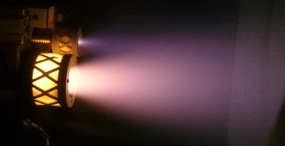
BIT-3 RF Ion Thruster and BRFC-1 Cathode on Iodine

NASA Science Mission Directorate "Fleet Chart". Image: NASA (2020)